

An incredible sunrise graces this image of Loop Head from the air on an October morning. Image via Peter Cox.
Witness Ireland as you’ve never seen it before – through the eyes of a drone. Photographer Peter Cox has produced a book of photos taken using drone-based cameras to capture Ireland’s stunning landscape from the air.
The new book, Atlantic Light, was crowdfunded through a Kickstarter campaign and attracted funding from more than 700 backers.
It consists of 60 photographs illustrating Ireland’s Wild Atlantic Way from Kinsale in Cork to Inishtrahull off the coast of Malin Head.
Along the way, Cox suffered setbacks, including losing a drone when it was attacked by an overly curious bird. There was also a moment of excitement when his drone lost a rotor blade and nearly plunged into the sea off Loop Head in Clare.
Atlantic Light: Motion to Stills from Peter Cox on Vimeo.
“Drones offer incredible flexibility for the landscape photographer,” Cox explained.
“They have many advantages over traditional aircraft, such as their low cost to operate, and the ability to fly at the drop of a hat if conditions look promising.”
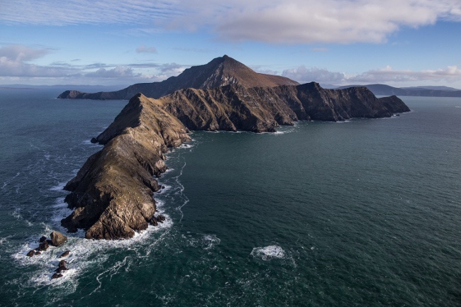
A not-often seen image of Achill Head on Achill Island. Made from the air, the dramatic headland extends like a finger into the Atlantic.
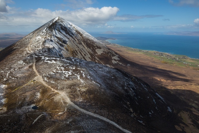
An aerial view of Croagh Patrick in Mayo
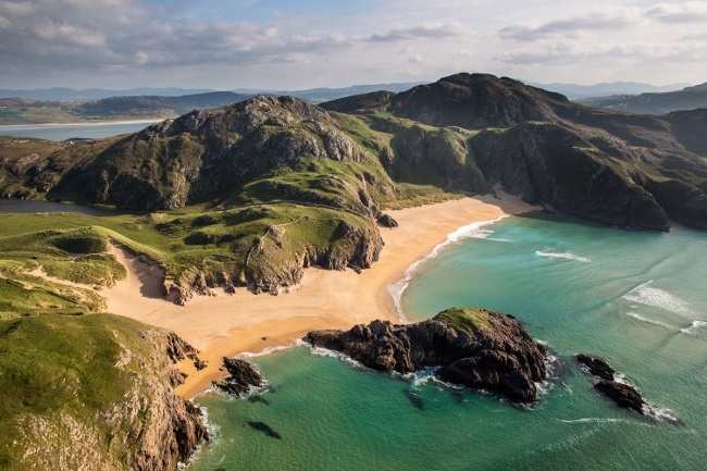
Known locally as the Murder Hole, this beautiful secluded beach belies its dark name.

Dog’s Bay Galway by aerial drone
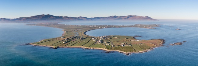
A panoramic view of the Maharees with Brandon Mountain behind on a cold winter’s morning.
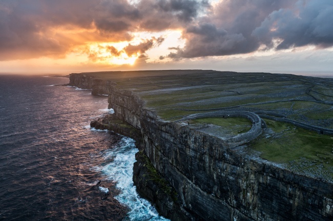
Sunrise at Dun Aonghasa in Galway
Atlantic Light: The West Coast of Ireland in Photographs by Peter Cox has an RRP of €29.95 and is on sale from his website and from all good bookshops nationwide.


